
Old-Time Map-Making
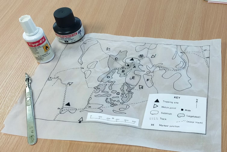
In a company that is celebrating its 35th year in 2025, there does tend to be an accumulation of clutter. Sorting through a pile of old reports recently I came across one with some maps from a 1987 field survey in Saudi Arabia (before NatureBureau was incorporated). I showed them to our graphic designer, Daniela, and told her how they had been prepared in the age before QGIS, ArcInfo, Google Earth, scanners and the rest. She was astonished.
First, the map had to be traced from a hard copy. This involved using Rotring technical pens with different nib sizes to change the line thickness for boundaries, contours and features. They were a real fiddle, always clogging up and needing cleaning while trying to keep the permanent ink away from clothing. Mistakes could only be corrected with Tipp-Ex which in them days had an organic solvent… Lettering and symbols were applied by pressing them down from costly transfer sheets (usually Letraset). Any mistakes were scraped away with a scalpel.
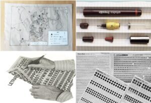
The finished drawing was then photographed using a “process camera” – we once had a small dark room in our office to house it. The image pasted in to a report for printing. The pasting was done with a special mounting spray that allowed the artwork to be moved if needed, and we used it in a booth that sucked the sticky excess into a filter.
All of this could easily take two days for just a simple black-and-white map! If colour was involved, we had to make overlays of the artwork with masks for the two or four colours involved, making the process even more complicated and lengthy.
Nowadays, we can see virtually everywhere in the world with Google Earth, and some areas like the UK are covered by high-resolution aerial photographs as well. Google Maps Streetview often allows us to see and assess properties that we plan to visit for bat surveys. Modern mobile phone navigation receivers using the EU’s Galileo system can locate positions to 3 metre accuracy. We can then use the What3 Words app to precisely locate our 10 x 10 metre habitat survey quadrats. We can use open-source geographic information system programmes such as QGIS to produce multi-layer mapping and 3D terrain modelling in just a few clicks. Indeed, the problem now is not so much making a map, but knowing how to usefully explore and interpret the vast digital resources available! For that, we increasingly see AI come to the fore and wonder where map making will go next, but it will never be as much fun as hand-crafting a map old time style.
By Paul Goriup, Director of Ecology
Interested in some of the work behind our news and blogs?
Contact the team now to speak to us about any ecology or design endeavours you may need support with…
Want to learn more about the team members mentioned in these articles?
Visit our team member profiles below to find out our specialisations and experience!